In today’s fast-paced digital world, location-based marketing depends on more than just good ideas. It thrives on the backbone of accurate data.
From creating personalized offers to driving foot traffic, businesses unlock value through pinpoint precision. It’s not just about knowing where your customers are; it’s about understanding how they move and what motivates them to act.
Accurate location data is reshaping industries like retail, travel, and finance in ways we once thought impossible. Let’s explore how it happens.
How Location Data Powers Targeted Promotions
Accurate location data takes guesswork out of promotions. Businesses craft offers tailored to a customer’s immediate needs and environment, boosting effectiveness.
Here’s how it works:
Localized Offers
– Retailers push discounts based on nearby stores or weather conditions. For example, imagine an ice cream shop sending summer coupons only during heatwaves in your area.
Hyper-Targeted Campaigns
– Restaurants send exclusive lunch deals to office-goers within walking distance between noon and 2 PM – simple yet effective.
Improved Ad Relevance
– Geo-fenced ads ensure customers see promotions tied directly to their location, like events at the local community center or festivals near them.
Reliable systems are essential for accurate targeting. Securing communication channels plays a key role in this process – setup Postfix with DKIM to ensure promotional emails stay trustworthy for recipients, all while protecting against phishing threats.
Improving Customer Experiences with Geolocation Insights
Precise geolocation adds depth to understanding your customer behavior beyond purchases alone.
Here’s what brands can achieve:
Behavioral Patterns: A bank observes high ATM use in certain areas during weekends and installs additional machines for convenience.
Smarter Delivery Options: Food delivery platforms assign drivers closer to restaurants or customers, reducing wait times significantly.
Amazon pioneered this by strategically placing warehouses worldwide to optimize efficiency. This approach benefits end-users through faster delivery and businesses by boosting satisfaction, loyalty, and repeat interactions.
Companies adopting similar models can enhance operational benchmarks, ensuring dependable and sustainable eCommerce practices that foster trust and long-term customer relationships.
Using Real-Time Data to Increase Foot Traffic
Real-time location data transforms how businesses drive customers to physical locations. It’s about being in the right place at the right time.
Here’s what that looks like:
Event-Based Offers: Retailers near sports arenas send fans post-game discounts, capitalizing on increased traffic.
Proximity Alerts: Coffee shops notify nearby passersby of a flash sale or happy hour specials during peak hours.
Crowd Management: Theme parks use real-time data to guide visitors toward less crowded attractions, improving overall experience.
Retail chains like Target use geofencing paired with customer apps to offer exclusive deals when users enter their parking lot, increasing in-store visits and purchases instantly.
The Last Word on Accuracy in Modern Marketing Efforts
Accurate location data is the cornerstone of impactful marketing. It sharpens targeting, enriches customer insights, and boosts engagement in real-time. Businesses investing in reliable data tools unlock strategies that resonate deeply with audiences while driving measurable results across industries.
The automotive industry is undergoing a transformation like never before, and at the heart of this change is the Internet of Things (IoT). From enhancing vehicle safety to optimizing traffic flow and reducing emissions, automotive IoT is playing a pivotal role in shaping the future of sustainable mobility.
What is Automotive IoT?
Automotive IoT refers to the integration of Internet of Things (IoT) technology into vehicles and their surrounding infrastructure. This involves equipping cars with sensors, communication systems, and software that connect them to the internet, other vehicles, and external systems. This connectivity creates a dynamic ecosystem where data can be exchanged in real time to improve functionality, safety, and efficiency.
Through automotive IoT, vehicles gain the ability to perform tasks like real-time navigation, predictive maintenance, and vehicle-to-everything (V2X) communication. V2X, in particular, allows cars to communicate with traffic lights, nearby vehicles, and even pedestrians, enabling smoother traffic flow and reducing the risk of accidents.
By connecting vehicles to a larger digital network, IoT enables smarter, safer, and more sustainable transportation systems. From improving fuel efficiency to enhancing driver experiences, IoT in the automotive industry is shaping the future of mobility in ways that were once unimaginable.
The Role of IoT in the Automotive Industry
IoT is more than just a tech buzzword—it’s a game-changer for the automotive sector. By enabling seamless communication between vehicles, infrastructure, and drivers, IoT is solving some of the most pressing challenges in mobility and sustainability.
Enhancing Vehicle Efficiency
IoT-powered systems allow vehicles to monitor and optimize their performance in real time. Sensors embedded in engines, tires, and other components provide continuous feedback, helping drivers and fleet managers make data-driven decisions to improve fuel efficiency and reduce emissions.
Example: IoT-enabled electric vehicles (EVs) can monitor battery usage and provide route suggestions to minimize energy consumption, extending the vehicle’s range while reducing its carbon footprint.
Supporting Connected and Autonomous Vehicles
IoT is the backbone of connected and autonomous vehicles (CAVs). These vehicles rely on IoT to communicate with other cars, traffic signals, and road infrastructure, enabling features like adaptive cruise control, lane-keeping assistance, and automated parking.
By making driving safer and more efficient, IoT in the automotive industry accelerates the adoption of CAVs, which are key to reducing traffic congestion and minimizing accidents.
Revolutionizing Fleet Management
IoT is transforming fleet management by offering real-time insights into vehicle health, driver behavior, and route optimization. Fleet operators can monitor vehicles remotely, track fuel consumption, and receive alerts about maintenance needs or potential issues before they lead to costly breakdowns.
For example, IoT systems can analyze driver behavior to identify habits like harsh braking or speeding, which can be addressed to improve safety and fuel efficiency. By enhancing operational visibility, IoT helps fleets reduce costs, improve safety, and contribute to sustainability efforts.
Automotive IoT Solutions Driving Sustainability
IoT isn’t just improving convenience and safety—it’s driving meaningful progress toward sustainability. Here are some of the most impactful automotive IoT solutions reshaping the industry:
Smart Fleet Management
Fleet operators are leveraging IoT to monitor and optimize their vehicles’ performance, ensuring efficient routes and minimizing fuel consumption. IoT-based telematics systems track data such as vehicle speed, engine health, and fuel usage in real-time.
This allows companies to reduce operating costs while contributing to environmental sustainability. For instance, logistics companies can use IoT insights to optimize delivery routes, cutting down on unnecessary mileage and emissions.
Predictive Maintenance
IoT sensors can detect potential issues in a vehicle before they become major problems. Predictive maintenance systems analyze data from these sensors to alert owners or fleet managers when a component needs attention.
This proactive approach reduces waste by extending the lifespan of parts, prevents breakdowns that could disrupt traffic, and minimizes the environmental impact of emergency repairs.
Vehicle-to-Everything (V2X) Communication
V2X technology, powered by IoT, allows vehicles to communicate with each other (V2V), infrastructure (V2I), and pedestrians (V2P). This connectivity helps prevent accidents, reduce traffic congestion, and optimize fuel usage.
For example, cars can receive real-time updates from traffic signals to avoid idling at red lights, which significantly reduces fuel consumption and emissions.
IoT-Enabled Electric Vehicles
The transition to electric vehicles (EVs) is a cornerstone of sustainable mobility, and IoT is playing a vital role in this shift. IoT helps EVs achieve smarter charging, better battery management, and improved integration with renewable energy sources.
Smart Charging: IoT allows EVs to charge during off-peak hours, reducing strain on the grid and lowering costs.
Battery Health Monitoring: Sensors provide insights into battery performance, ensuring optimal usage and longevity.
Grid Integration: IoT enables EVs to act as energy storage units, feeding excess electricity back into the grid when needed.
The Sustainability Impact of IoT in the Automotive Industry
IoT is a catalyst for sustainability in the automotive world. By connecting vehicles, infrastructure, and people, it creates systems that are efficient, eco-friendly, and resource-conscious. These innovations are helping the industry move toward a future that prioritizes environmental responsibility without compromising functionality or convenience.
Reducing Carbon Emissions
One of the most significant contributions of IoT for automotive is its potential to reduce greenhouse gas emissions. Smart routing technology helps vehicles avoid congested areas, cutting down on idling and unnecessary fuel consumption. Additionally, IoT-powered vehicle optimization ensures that engines, tires, and other components operate at peak efficiency, further reducing emissions.
IoT also supports the integration of electric vehicles (EVs) into the transportation ecosystem, making it easier to manage charging schedules and monitor battery performance. This reduces reliance on fossil fuels and aligns with global goals for carbon neutrality.
Promoting Circular Economy Practices
IoT encourages circular economy practices by enabling better recycling and reuse of vehicle components. Predictive maintenance ensures parts are used to their full potential, reducing waste from premature replacements. For instance, sensors can identify when a component is nearing the end of its life and recommend refurbishment or recycling instead of outright disposal.
Moreover, IoT-enabled tracking systems make it easier to recover and recycle materials like metals, plastics, and batteries. This closed-loop approach minimizes resource extraction and landfill waste, creating a more sustainable lifecycle for vehicles and their components.
Supporting Smarter Urban Planning
IoT doesn’t just benefit individual vehicles—it also plays a role in smarter urban planning. Connected systems allow cities to gather data on traffic patterns, parking demand, and public transportation usage. This information enables the design of more efficient urban layouts that reduce congestion, improve air quality, and promote the use of shared or sustainable mobility options.
By addressing sustainability at both the micro (vehicle) and macro (infrastructure) levels, IoT in the automotive industry is paving the way for a greener, cleaner future.
Final Thoughts
IoT in the automotive industry isn’t just about smarter cars—it’s about creating a more sustainable and connected world. From reducing emissions to optimizing resource use, automotive IoT solutions are paving the way for a future where mobility is efficient, eco-friendly, and accessible.
Whether it’s the rise of electric vehicles, autonomous driving, or smart city integration, IoT is at the heart of these advancements. As the technology matures, its potential to transform the automotive sector—and the planet—is limitless.
The journey toward sustainable mobility starts now, and IoT is driving us forward. Are you ready to embrace the future of transportation?
We live in the “I want it now” world. This means that supply chains are not just important. It makes them the lifeline of global commerce.
Whether it’s delivering some super gadget to a customer in Tokyo, or getting bananas in a New York supermarket while they’re still edible, supply chains are what makes the world go. A sort of behind-the-curtain magic.
But, magic doesn’t just happen by itself. Behind every new gizmo (or a green banana) in your hand is a mountain of data. And, in its heart, is the location-based data – a not-so-secret weapon to improve supply chain efficiency.
What Is Location-Based Data Integration?
In simple terms, integrating location-based data means combining real-time location information with other data sources to make smarter decisions. It’s like giving your supply chain the ability to see, think, and act based on “where” things are happening.
This doesn’t mean just slapping a GPS tracker on a truck and feeling good about yourself. It’s about using that GPS data alongside weather updates, traffic patterns, warehouse inventory levels, and even geopolitical insights.
If, or when, you do it right, it will transform your supply chain from a reactive process into a proactive one.
Why Should You Care?
Customers demand speed, accuracy, and transparency. They don’t just want to know that their package is arriving. They want to know when will that happen, where is the package now, and why isn’t it here yet.
A clunky and inefficient supply chain brings the risk of losing money and customers. And nobody wants to be that company that gets memed about for lost deliveries and long delivery times.
Integrating location-based data improves your operations, minimizes delays, reduces costs, and, most importantly, boosts customer satisfaction. It also can make your competitors look like they still use carrier pigeons.
The Real-World Applications of Location-Based Data Integration
Let’s talk specifics. Here are a few ways companies use location-based data integration to dominate their supply chain game.
1. Route Optimization
Imagine this: a truck loaded with fresh produce is about to hit rush hour traffic. With location-based data, that truck can reroute instantly, saving time and preventing spoilage. Companies like UPS and FedEx swear by this kind of technology. UPS’s ORION system reportedly saves millions of gallons of fuel annually by optimizing routes.
2. Inventory Management
Warehouse managers no longer need to play hide-and-seek with stock. Warehouse automation technologies and real-time location data allow precise tracking of inventory, reducing errors and improving restocking efficiency. When inventory is tied to its geographic location, companies avoid overstocking or understocking. This prevents those awkward “sorry, we’re out of that” moments.
3. Predictive Maintenance
Picture this: A delivery truck breaks down in the middle of a desert. Now imagine avoiding that scenario entirely. With integrated location data and IoT sensors, companies can predict vehicle maintenance needs based on usage patterns and location history. This keeps fleets on the road and customers happy.
4. Dynamic Pricing
Ever noticed how ride-hailing apps adjust prices based on demand and location? Supply chains can adopt similar strategies. By analyzing location-based data, businesses can dynamically adjust shipping fees or prioritize high-value deliveries. It’s like your supply chain is a savvy salesperson, knowing when to upcharge.
5. Disaster Management
Natural disasters or political unrest can disrupt supply chains. Location-based data integration helps companies identify at-risk regions and reroute shipments or adjust inventory plans. This minimizes the unplanned disruptions and keeps operations running smoothly.
The Technology Behind the Magic
Location-based data integration needs a blend of technologies to work properly. But don’t worry, it’s not as complicated as it sounds. Let’s demystify the tech:
1. GPS and GIS
GPS technology provides precise, real-time tracking of your assets, like vehicles, shipments, and equipment. It is the backbone of location-based data integration, ensuring that businesses know where their resources are, down to exact coordinates.
Pair it with Geographic Information Systems (GIS), and the data becomes even more powerful, providing contextual information such as road conditions, terrain, and infrastructure layouts.
2. IoT Sensors
Internet of Things (IoT) sensors can turn your ordinary assets into smart, data-generating machines. They can track many critical factors, like truck speed, fuel usage, or the temperature of a refrigerated container.
All this information comes in real-time, which can help you maintain optimal conditions, prevent damaged or spoiled goods, and even address potential issues before they become a costly problem. IoT sensors make your supply chain more transparent, proactive, and efficient.
3. AI and Machine Learning
Artificial Intelligence (AI) and Machine Learning (ML) can help you transform the raw data into useful insights. They analyze historical trends alongside real-time data, helping them identify inefficiencies, predict patterns, and recommend the best possible actions.
For example, AI might suggest alternative routes to avoid traffic jams or optimize delivery schedules based on weather forecasts. Your supply chain benefits from faster decision-making, fewer mistakes, and huge cost savings. And the best part? It gets smarter with every mile.
4. Cloud Computing
Cloud computing stores and processes massive amounts of data in the cloud, and businesses gain the flexibility to scale operations and access information from anywhere.
This means real-time updates, seamless collaboration, and rapid problem-solving, regardless of the stakeholders’ location. With the cloud in the mix, supply chains shed the limitations of traditional systems, becoming more dynamic and resilient in the face of challenges.
How to Get Started with Location-Based Data Integration
You’re probably thinking, “This sounds great, but how do I do it?” Well, have no fears. Here’s your step-by-step guide:
1. Assess Your Current Setup
Look closely at how your supply chain operates. Try identifying the pain points, and determine what is slowing it down. You can start by analyzing delays, inefficiencies, and understanding where do you waste resources.
If you locate these bottlenecks, you can focus your efforts and make sure that the location-based data integration is applied to the areas with the most significant potential for improvement. A clear starting point that you understand properly will set the foundation for a successful transformation.
2. Choose the Right Tools
Every business is unique. This means that a one-size-fits-all approach will not work with selecting location-based data tools. Consider the size and complexity of your supply chain, alongside with your budget and long-term goals.
Popular tools include:
Google Maps Platform: Offers geospatial APIs for route optimization and location tracking.
Geotab: A leader in telematics and fleet management solutions.
ESRI’s ArcGIS: A robust GIS platform for visualizing and analyzing location data.
Look for the tools that would easily integrate with your existing system, and provide scalability as your business grows. Consider finding the right tools as an investment that should drive measurable results without overloading you with unnecessary features.
3. Train Your Team
Technology is effective only as much as the people using it are. So, make sure your team understands how to make the best out of the location-based data and turn the insights it provides into good decisions.
Regular training sessions, workshops, or gamified learning modules will help build confidence and encourage a data-driven mindset in your workers. It will also help your team embrace these tools, and become active participants instead of just passive users of technology.
4. Start Small
Start by testing location-based data integration on one small part of your supply chain. It could be a specific warehouse, delivery route, or product line. This will allow you to iron out any technical or operational issues without overwhelming your entire business.
A small-scale pilot will help you refine the process, build trust with your stakeholders, and demonstrate early success. It also reduces risks while laying the groundwork for a broader rollout in the future.
5. Monitor and Iterate
There is no putting it another way: you must track the performance to truly understand its impact. Use KPIs like delivery accuracy, costs of operations, and customer satisfaction to measure your progress.
The “Set it and forget it” approach won’t work here. Analyze the data regularly, and adjust your strategy to maximize results. Iteration will make sure your supply chain continues to grow and adapt to new challenges.
Final Thoughts
Location-based data integration is a game-changer for supply chains. By combining real-time location data with other insights, businesses can achieve unparalleled efficiency, reduce costs, and keep customers smiling. Sure, it requires investment and effort, but the payoff is worth it.
So, the next time you’re tracking a package and it arrives exactly when promised, remember: it’s not luck. It’s location-based data integration at work. And maybe, just maybe, that’s the real magic behind modern logistics.
This guide will tell you everything that you need to know about location data:
Introduction
The global adoption of smartphones has grown at incredible speed in the last decade.
Mobile devices are a powerful tool for understanding the aggregated behavior of consumers.
Understanding device location opens doors to a wide range of use cases that are unique in many different ways.
Mobile location data provides a granular solution for consumer understanding. Combining this understanding with other datasets is helping to solve business problems and achieve goals across many different industries.
Many companies are now partnering with a nearshore software development center to build advanced platforms that can process and analyze mobile location data efficiently, ensuring faster deployment and closer collaboration across time zones.
For these reasons, location data has quickly become the holy grail of mobile. Its applications are broad and run across a number of different industries and verticals.
But before we get onto that, what exactly is location data?
What is location data?
The smartphone
The mobile device or smartphone has been revolutionary. Its growth has been incredible – many predict that there are now more of these devices in the world than there are people.
Smartphones have transformed everything about our everyday lives -we rarely leave home without it, and it’s always on our person, ready to provide us with instant information or guidance.
These devices have enabled the location data industry to understand how audiences move and behave in the real world. This information is location data. It comes in many different forms and from various sources.
What is location data?
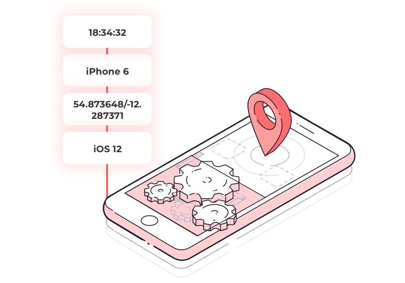
Location data is geographical information about a specific device’s whereabouts associated with a time identifier.
This device data is assumed to correlate to a person – a device identifier then acts as a pseudonym to separate the person’s identity from the insights generated from the data.
Location data is often aggregated to provide significant scale insights into audience movement.
How is location data generated?
Companies are collecting location data in many different ways. There are several different techniques to collect location data. These techniques differ in reliability (but more on that later).
For now, the primary process of collecting location data requires the following ingredients.
A location source/signal
The first ingredient is a location signal. This signal is not a product of the device itself – it comes from another piece of technology that produces signals. The device listens to these external signals and uses it for positioning. These signals are as follows:
GPS
GPS is shorthand for the global positioning system and was first developed in the 1970s. The system is made up of over 30 satellites which are in orbit around the earth. This technology works in your device by receiving signals from the satellites.
It can calculate where it is by measuring the time it takes for the signal to arrive.
GPS location data can be very accurate and precise under certain conditions, mostly in outdoor locations. In the best instances, the signal can be reliable down to within a 4.9 metre radius under open sky (source). For practical, consumer-level applications like real-time vehicle security and fleet monitoring, dedicated GPS Trackers leverage these signals to provide live location, movement alerts, and recovery assistance.
Wi-fi
Wi-fi networks are another source of location signals that are great at providing accuracy and precision indoors. Devices can use this infrastructure for more accurate placement when GPS and cell towers aren’t available, or when these signals are obstructed.
Beacon
Beacons are small devices that are usually found in a single, static location. Beacons transmit low energy signals which smartphones can pick up.
Similarly to Wifi, the device uses the strength of the signal to understand how far away from the beacon it is.
These devices are incredibly accurate and can be used to place a location within half a meter with optimal signal strength.
Carrier data/cell towers
Mobile devices are usually connected to cell towers so that they can send and receive phone calls and messages. A device can often identify multiple cell towers and by triangulation, based on signal strength, can be used to place a device location.
An identifier
Each smartphone needs to be associated with an identifier to understand movement over time. This identifier is called a device ID. For iOS, this is called an Identifier for Advertising (IDFA), and for Android, it’s called an Android Advertising ID (AAID).
Meta data or additional dataset (optional)
A location signal combined with an identifier will allow you to see the movement of a device over time. However, for more detailed insights and to get more value from location data, you’ll need some metadata or an addition dataset.
The most common dataset to do this is a POI dataset. This dataset includes points of interest that are important when comparing how audiences move and behave in the context of the real world..
For example, a series of latitudes and longitudes showing how Londoners move between 7-10am could be useful. Tying this to a dataset that included tube stations and key travel routes would allow you to do much more with the initial data.
Location data sources – where does location data come from?
So, we have already looked at the ingredients that combine to make location data, including the different types of location signals. However, what are the sources of location data? If you are looking to use location data in your organization, then you need to know the differences between every potential source. It’s also important to have a data governance strategy to manage the data effectively.
The source can have a significant effect on accuracy, scale and the precision of devices. So, from where does location data come? There are three primary sources:
The bidstream
A sizeable proportion of location data comes from something called the bidstream (also referred to as the exchange). The bidstream is a part of the advertising ecosystem. Don’t worry if you’ve never heard of this – we’ll explain everything.
Explainer: The ad buying ecosystem
The ad buying ecosystem
Before we talk about bidstream data, it’s helpful to understand how ads are bought and sold.
Direct deals with publishers such as an app, site, or network.
Ad networks which group ad inventory to sell it to advertisers
Ad exchanges provide a solution for publishers to offer up their inventory programmatically, allowing advertisers to buy it in real-time. Purchasing advertising inventory in this way produces a bid request.
Why is this relevant for location data I hear you ask? In every bid request information is passed on – this data contains several attributes used to determine whether to serve the ad on the device.
Included in this dataset is a form of device location. A company will package up this location data, and the result is the bidstream location data that is available today.
Bidstream location data is appealing because of the sheer amount of it – it can very quickly provide a large amount of scale. However, bidstream data also comes with specific issues – it can be inaccurate, inconsistent, and even fraudulent. Because it’s captured programmatically ,then bidstream location data also has the benefit of being immediately actionable.
“Up to 60% of ad requests contain some form of location data. Of these requests, less than a third are accurate within 50-100 meters of the stated location”
Telcos
Remember, in the last section, when we identified location signals? Cell tower location is one of these and is the process of triangulating the strength of mobile cell tower signals to place the device in a specific location.
This kind of location comes directly from a telecommunications company (telco). Usually, they have some demographic data associated with the location data.
Similarly to bidstream data, the scale that telcos can offer (they have an extensive reach as in many countries few companies serve the entire population) is appealing.
However, in the same way, this scale is masking many issues with the accuracy of the data. Some studies have found that as little as 15% of data sampled was incorrect.
Location SDKs
A software development kit (SDK) is a toolkit that app publishers can add to their app to provide third party functionality. Developers add location-based SDKs to their apps to access the most precise and accurate location data signals from the user’s device.
Location SDKs come in many shapes and forms – some make use of the core location functionality present in the OS, others do a degree of data processing on top, to boost accuracy.
Some SDKs only operate in the integrated app when the app is open. Others can run in the background to gain broader insights into the movement and behaviors of the device.
Location-based SDKs collect data with the user’s consent – the apps native permissions often collect this consent, but some SDK providers offer consent tools to ensure that the location based app is collecting data in accordance with relevant regulations.
The difference between SDK generated data, and other sources of data can be seen in the accuracy and precision of datasets. Data collected by location SDKs are more accurate because they can listen for multiple location signals.
For example, SDKs can use the device’s built-in GPS to place the device and then, using Bluetooth signal strength from beacons, verify and fine-tune the location of the device down to within a meter of accuracy.
Location SDKs usually have a more sophisticated way of understanding how the device is behaving. For example, the Tamoco SDK uses motion behavior and other entry/exit events to know when a device visits a venue or location.
Why isn’t all data collected using SDKs?
If location SDKs are the most accurate and highly precise, then why don’t we use them to collect all location data?
The issue with many location SDKs is that they require integration into a publisher’s app. This app then needs to cover an adequate number of devices before the data is representative enough to gain any valuable insight or relevant patterns.
However, some SDKs have been built with functionality that benefits the publisher and limits battery usage to a minimal level. These SDKs are the ones that have achieved significant scale.
For example, the Tamoco SDK is optimised to send data in batches to minimise the number of requests. We also modify how data is collected depending on the current battery level.
All of these factors are a direct result of a close working relationship with our developer partners and allows the Tamoco SDK to scale along with our partners.
Publisher datasets
It’s possible to obtain location data directly from app publishers. Some publishers have developed methods of obtaining location by using the devices inbuilt location services.
These will usually coincide with a location-based process within the app – such as looking up a nearby restaurant.
These are often not as accurate as the location SDKs that have been carefully built to collect verified location signals. However, they can be a good source of location data as long as you can validate and understand the process of data collection put in place by the publisher.
We’ve already said that good location data is accurate and precise. However, let’s take a step back and ask ourselves a question – what do we actually mean by accurate and precise location data?
Location data collected by smart devices usually come in the form of a latitude and a longitude coordinate, or a lat/long. This reading refers to the perceived location of the device at the time.
However, how can we make sense of this number and understand if it’s accurate?
Location accuracy v location precision
You might think that accuracy and precision can be used interchangeably. However, in the world of location data, they have different meanings
Accuracy
Accuracy is a measurement that helps us to understand how close the device’s geographical reading is to the actual location of the device.
So how do we measure accuracy? The location accuracy of the device changes depending on the type of signal and the device. Accuracy is measured by looking at the signal type (GPS, wifi, cell tower). The device provides us with a reading of the location and then an accuracy rating. This unit is usually a measure of distance and is the margin of error associated with the measurement.
Precision
Precision is the level of detail associated with the location measurement. The more this is is similar to the other measurements in the dataset, the more precise the data is.
In location terms, we use lat/long to measure this. Firstly we check to see if the data points are realistically within the same area.
The number of decimal points in the lat/long is essential in measuring the precision of location data. The more digits there are after the point, the more precise the data is.
The following table helps to explain precision when looking at lat/long:
Decimal Places
Decimal Degrees
DMS
Qualitative Scale
0
1.0
1° 00′ 0″
Country or large region
1
0.1
0° 06′ 0″
Large city or district
2
0.01
0° 00′ 36″
Town or village
3
0.001
0° 00′ 3.6″
Neighborhood, street
4
0.0001
0° 00′ 0.36″
Individual street, land parcel
5
0.00001
0° 00′ 0.036″
Individual trees, door entrance
6
0.000001
0° 00′ 0.0036″
Individual humans
Not all mobile location data is equal
As many in the industry have stated: the type of location data and methodology is of significant importance. The relevancy of different kinds in different scenarios is often contented.
Mobile location data requires some fundamentals to provide granular insights that we discussed earlier.
So what’s the best way to accurately and precisely collect location data and what happens when signals such as GPS aren’t working?
We think this is another argument for SDK generated data. For example, the Tamoco location SDK can listen for multiple signal types simultaneously. Processing these signals allow the SDK to measure accuracy and then determine which signal to use.
Our SDK, therefore, uses Bluetooth and Wifi to help position the device in areas where GPS signals are weak. This sensor agnostic approach means that the SDK can place the device with better accuracy and more precision by using multiple signals.
Remember, when we talked about the three main ingredients that combine to produce location data. We’ve covered the device and its identifier. We’ve also covered the signals that the device used to position itself.
However, we are yet to cover the additional data that is needed to make use of the dataset. As we have discussed location data is usually a lat/long associated with a device and a timestamp.
We need to understand what this location is to make any use of the data. Knowing a device location is half of the challenge. To do this, we use database that allow us to connect this online data to the offline world. We call this a POI dataset.
What is POI
A point of interest (POI) dataset is a data representation of the physical world. A single POI is a geographic boundary and is usually associated with a physical location (think a store or building).
As with location data POI datasets come with a series of challenges including accuracy. Business regularly move, and as changes happen in the real world, the datasets evolve accordingly.
At Tamoco, we set up our own Place database to explore-in-depth how devices move and behave in the offline world. This database is slightly different from a POI dataset.
Explainer: Tamoco places
Contains metadata associated with the place – opening hours, floor level, polygon footprint and other essential information that can help to verify if a device entered the POI.
Combines with an associated geographical boundary (geofence) that can be used to understand the device activity inside and how long it stays inside.
Combines with any known sensors (beacons, Wifi, or other signal based tech) to help understand when a device is visiting the POI and not in fact staying in a place nearby.
What’s the importance of POI?
Perhaps the best way to understand the importance of a useful POI dataset is by using a real-world example.
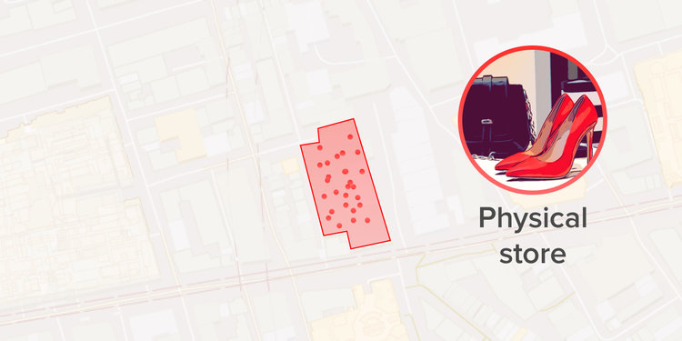
No POI
In the above example, we don’t have a POI dataset. We have multiple lat/long, which might be accurate and precise, but we get no value from this as we have no connection to the real-world.
Bad POI
Here we have a POI dataset which connects the lat/long to a physical location. However, the POI is slightly in the wrong place, which means we think the device has visited the coffee shop, but they are waiting outside, or elsewhere. The implications of this will become more evident in the next section.
Places database
Here we have a place with opening hours and altitude. We have a geofence which allows us to see when the device enters and exits. We also have a Wifi and beacon sensor that we know is inside the coffee shop. Using this, we can verify with accuracy that the device was inside the place.
Connecting location to POI
At Tamoco, we do this through a process called visits. This methodology is a powerful data science technique that allows us to validate whether the device is inside a place and to say with a level of accuracy how long a device was inside.
Where other data providers will claim a device is inside a store if a single lat/long shows up inside a POI, we go much further.
What happens if this single data point is an outlier from a car driving past. What if the POI is in the wrong place?
Tamoco uses essential device information (yes, this is possible only by using a location SDK) such as motion type to verify visits to a place and filter out any false visits.
Location data use cases – how to use location data
Hopefully, by this point, you will have understood more about how location data is collected and how device location is used to understand the connection between online and offline.
However, what are the uses for accurate and precise datasets? How can your business benefit from adding location data to your business? How do you integrate this data effectively?
Segmentation and targeting
Marketers are always looking for ways to identify relevant audiences for their advertising campaigns. They want to segment their audiences as much as possible to maximize campaign relevancy and convert more users into paying customers.
Location data is an effective and unique method to achieve those goals. The reason for this is that location is a significant indicator of behavior, interests, and intent.
For marketers, the patterns that you exhibit can be used to create a very detailed image of what you look like as a consumer. Location data helps to create an accurate representation of your interests, and this can be used to bring more targeted and relevant ads to potential customers.
When using location data to target audiences, there are a few things to consider. Depending on the business and the campaign marketers may use a different combination of each of these in a single campaign.
Real-time v historical
Marketers might want to run a different campaign depending on the kind of data available to them. One way that they do this is based on time.
Realtime
Realtime location-based targeting involves identifying when a device is in the desired location and usually involves a mobile targeting. The process is simple – when the user is in the desired location, deliver an advert instantly on that users device through programmatic advertising.
Historical location targeting
This form of targeting is usually called retargeting, and it is similar to real-time that we discussed above. The difference is that over time, the devices that appear in a predefined location are used to build an audience. The advertiser will then retarget this audience at a later date.
Visits vs interests
Visits
Targeting based on visits is a clear way of building an audience that has visited real-world locations such as a specific coffee shop.
Depending on the value of the POI database this can be extended to include devices that have visited all of the stores across a brand (for example every Starbucks) or every visit to a type of venue (example – visits to coffeeshops in Austin).
Interests
Using location to target people based on interests is another way of reaching a highly specific audience. This method is similar to visits but usually consists of several repeat visits to a location or combined visits that fit particular criteria.
For example, an interest-based target audience, such as big coffee drinkers could contain devices that have visited any coffee shop at least three times in a weekly period.
Another example could be active consumers – these could visit both a gym and a health shop within a month.
Interest-based location targeting is interesting because you can create very specific segments. However, as with other aspects of location-based targeting, the more specific you get, the less scale you can achieve with your campaigns.
Channels for location-based targeting + examples
By combining these, you can create highly targeted audiences using location data. But how do you then reach them?
Programmatic
Using device identifiers marketers can feed relevant devices into their programmatic stack to automatically buy ad impressions and target the desired devices in near real-time.
The same data can be used to retarget at a later date in a social feed or via another programmatic channel.
The benefits of this strategy are that you can automate a lot of the marketing process. By using location-based audiences, you can ensure that you are reaching the right audience with the right message.
Tamoco offers these as pre-built segments (both visit and interest based) that can be activated directly in your DSP for targeting, or in your Data Management Platform (DMP) for combining with other data sources.. This process can be used to reach consumers across several programmatic channels and on different devices.
Some examples
Drinks brand targeting consumers in real-time when they visit a venue.
In this situation, we would identify several venues that stocked the relevant products. By feeding visit data into the programmatic stack, it is possible to deliver mobile ads to the device while that visit is going on, or after the visit has occurred. This ad could appear in-app inventory or while browsing the web on the device.
Retargeting through social visitors to gyms with a health drink
Here visits to the category of gyms would be used to build an audience. Next, we would feed the audience into the social targeting platform (facebook ads or similar). The campaign would deliver the retargeting ads to the consumer in their social feed.
Targeting a competitor’s bank customers with a better offer
In this example, devices seen inside a competitor bank are targeted with advertising intended to initiate a switch to a new bank. The data would be historical and might include multiple visits to verify the person is a customer. This data could be used as part of a campaign across several different channels, depending on the marketing stack.
What about location-based segmentation?
The examples we have given include building a new location-based audience to feed into targeting solutions. However, the same principles can be applied to an existing audience.
For example, you can use location data to segment your audience into more specific segments and tailor each targeted ad to be more relevant to each segment.
Personlization & engagement
Today’s consumers demand a high level of personalized communication. Location data can help to bridge the gap between communication and personalization.
Location data can help to personalize ads and messaging to new customers. It can also help to personalize the customer experience.
Consumers want personalization, and everyone from marketers to product designers wants to deliver it.
Location-based marketing personalization
In marketing, location data can help to personalize ads, changing the creative for segments of the audience. This personalization is done by segmenting the ad audience based on location data behavior. These segments are then used to deliver creatives that are relevant to their behaviour – think ‘enjoyed your coffee today’?
Tailoring the ad message boosts personalization and boost the key metrics that marketers are always looking to improve
Location based engagement
Location technology can also be useful for personalizing the customer experience. Integrating a location SDK into your consumer-facing app can support location-based personalization, boosting engagement and retention in the long term.
For example, you can deliver contextual notifications when a user is in a relevant location. Remind users of items left in their app basket when they are nearby to a physical store, for example.
Using location to predict what your customers want
The data that marketers now have at their disposal has enabled them to do more than just personalize based on past consumer behavior.
Location datasets can take personalization to the next level. B2B content marketing personalization is becoming predictive. Brands and advertisers can now combine multiple data sources to understand how consumers behave on both a micro and macro level.
Using this information, it’s possible for marketers to become predictive with their personalization.
Marketers can continuously update their perceived customer profiles with data that explains a consumers profile clearly. This process helps the business to personalize the consumer journey and remove potential barriers to purchase.
Measurement and attribution
As we have seen, the world of marketing and advertising can benefit from using location data in their targeting, segmentation, and personalization strategies. However, location data is valuable in another area where marketers have struggled – attribution.
Advertising is usually quite easy to measure in the online world. If a consumer clicks an ad and makes a purchase, this can be measured and attributed pretty accurately to the ad.
However, what happens if the goal is a store visit instead? Marketers have been scratching their heads for years trying to solve this conundrum. Location data is the missing link that can connect the two.
Location data can act as the link between the online and offline, linking a digital programmatic ad to a store or venue visit.
This link allows marketers the ability to measure and quantify the return on investment from their campaigns. The same capability is useful for out of home (OOH) providers who are looking for a way to link their real-world ads to digital or physical conversions.
It always goes back to accuracy and precision
Location-based measurement and attribution are useful, but it requires data that accurately represents a consumer’s real-world behavior. This data needs to be more than just a single data point – marketers need to know with certainty that a store visit is attributed to an ad to measure ROI effectively.
This requirement is another argument for a place visits methodology that we have already discussed. Device characteristics such as motion and dwell time are essential in providing an online-offline attribution solution that accurately links digital ads to store conversions.
Examples
Digital campaign attribution
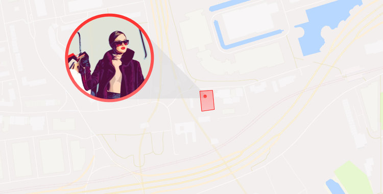
An agency is running a campaign for a clothing brand. The campaign is delivered to audiences programmatically. The campaign aims to drive footfall to stores stocking a new range.
The impressions and clicks can be measured by the agency, but the brands want to know if the campaign is driving customers to their stores.
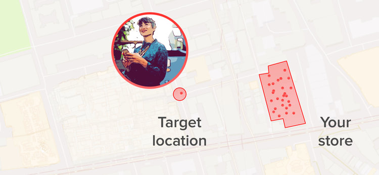
Using location data and matching against the IDFA/AAID’s targeted during the campaign, an exposed audience is created. A control audience is also built to compare the exposed group against users who weren’t targeted during the campaign. By having an exposed and control group who were equally likely to visit the clothing brands stores before the campaign, it is possible to isolate the impact the advertising had on store visits by seeing how store visits between the groups move during, and for a period after, the advertising period.
OOH
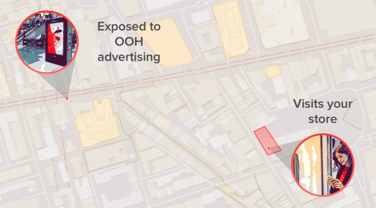
A brand runs an OOH campaign across multiple OOH sites and wants to understand which of these was the most effective in driving online purchases, or whether the OOH advertising was driving online purchases in the first place.
Through an accurate understanding of where the OOH sites are located, and by accurately and precisely understanding how a device moves in relation to the site (an accurate view of this needs to factor in how much time a device spends close the site, how fast they move past the site and a number of other factors the Tamoco SDK factors in) it is possible to build a group of devices that were likely to have been exposed to the OOH advertising.
These devices can be compared to similar devices that weren’t exposed to the advertising, and their device identifiers can be matched to customers in the companies CRM or DMP to measure the impact the OOH advertising had on store purchases as well as which of the OOH locations was the most effective in driving purchases.
Analytics and insights
Location data is a useful tool to analyze how large numbers of people move and behave to identify large scale trends and patterns.
These kind of insights are usually difficult to attain at scale in the offline world. Location data works as an indicator of where people go and how they behave – and how these change over time.
In the realm of advertising and marketing, location-based analysis can deliver valuable insights, such as:
Comparisons between brand, category, or another group of physical locations over time. Such models will look at the footfall changes over time.
A brand can use location data to understand more about its customer demographics – where they live and work, where else they shop
Insights into their store performance – average unique visits per month, number of repeat visits, average visit length.
This analysis can be used for a variety of adjustments. Including changing campaigns to suit the real-world behaviour better, to fundamentally changing market strategies to match the data of how a customer is behaving in the real world.
Beyond advertising
These same insights can be applied outside of the marketing and advertising vertical. Using footfall can be useful across a range of industries including retail, finance, real estate, healthcare, and government.
Retail
Location data can be useful for both smaller and large retailers. Understanding store visits, as well as customer behavior through mobile device data, is having many positive effects on the retail sector. These insights can help inform business decisions such as store layout, opening times, staffing, and more.
Finance
Location data is an essential tool for finance analysis. Device location can help to identify fraudulent activities and protect users with an added layer of security.
Understanding footfall through big data sets is valuable for the financial sector. Mobile device data can help to forecast earnings, number of customers and other KPIs before they are formally reported. These insights help to inform investment decisions.
Real estate
Anyone looking to invest in real estate, or open up a new store branch can use location data to understand how busy certain areas are, what type of people you’ll see in certain areas and how well similar businesses in that area perform.
Government
The rise in mobile location data has provided better opportunities to understand how cities work. It’s helping to create systems and infrastructure that reflects this.
Combined with the increasing number of connected devices in cities, central planning authorities now have a set of tools that can inform decision making in many different areas.
Mobile location data is contributing to a better understanding of where demand for public infrastructure is most significant. For example, we could examine mobile device location data to understand the most cycled roads within a city. This information is precise and invaluable when planning where to implement new cycling routes.
The same is true of traffic and congestion. In increasingly crowded and polluted megacities, it’s crucial to understand how traffic issues can be alleviated. Understanding traffic flow and where to build new road structures or introduce new low emission zones is vital to making the kind of smart city that can sustain current levels of population growth.
Location data can have a substantial positive effect on this kind of planning. Thanks to the accuracy and uniqueness of mobile device data and location intelligence, it is changing how decisions are made in cities and towns around the world.
Verification
Transparency – why do we need it
As the amount of location data available to businesses increases, there is likely to be more bad data. Poor third-party data sets are becoming more frequent, with providers unable to validate the accuracy and precision of the data.
We’ve already discussed the need to for accuracy and precision in location data – the difference can mean a falsely attributed visit, irrelevant targeting or a negative impact on customer engagement.
The most accurate providers will be able to verify their first-party data sets. They can provide a detailed methodology around how they collect data. This is one of the main benefits of working with a provider that controls data collection – their data is first-party and therefore reliable and transparent.
Explainer: 1st, 2nd and 3rd party data
Third party data is data that is purchased from outside sources where the provider you are working with is not the direct collector of the data.
Second-party data is somebody else’s first-party data. This data comes from their first-party audience, the source is clear, and the provider usually demonstrates the accuracy and collection.
First party data is your data that is collected directly from your audience or customers.
Of course many businesses don’t collect first-party location data so they work with a location data company to source the data for their campaigns, or other business needs.
In this scenario, second party data is much more reliable than third-party data. You can understand how the data is collected as the methodology is transparent, and the data accuracy can be verified. Of course, this doesn’t confirm that the data is accurate – but at least you can check yourself if this is true.
The best providers can explain how they collect data, how they filter out inaccurate data and can usually provide a reliability score with data to allow the end-user to understand the data they are working with.
Privacy
2018 saw the introduction of GDPR in Europe. In the US, the upcoming CCPA act data privacy will still be front and center in the data community. We are quickly moving towards a world where each individual will have control over their data.
Businesses using location data will need to take a similar approach. It’s pivotal to allow the individual to take control of their data. Businesses must inform users of how their data is used. They must provide clear opt-in and opt-out solutions so that transparency can be placed at the center of the big data revolution.
Businesses that utilize location data will need to be clear about how they collect and use consumer data. Location data providers need to have a clear opt-in process that allows consumers to understand how their data is used.
Data providers should provide solutions at the point of collection, which allow them to manage consent preferences through to the point of data use.
As with the verification of accuracy, understanding data privacy is more accessible if your provider is working with first-party data.
For example, at Tamoco, we have built consent functionality into our SDK. This allows the publisher to collect user consent at the point of data collection in accordance with the IAB framework.
For the data user, this means that they can understand how consent was given, and for which purposes.
When choosing a location data provider to work with, there are many things to consider. With several different sources, signals, and methodologies available, it’s essential to understand exactly what each provider is offering.
We have put together the following list of questions that are useful when selecting a location data company.
Buying location data
So you have a valid use case for location data, how to do you go about purchasing location data?
We have put together this section to help you to understand what to look for when working with location data providers.
What does good location data look like?
As we mentioned earlier, it’s important to look out for a few things when buying location data you should look for the following attributes.
Quality
In terms of quality, you want location data to be accurate, and you want it to contain the attributes that you need to achieve your goals. In terms of accuracy, you should look out for a score in the data set. This will tell you how much you can trust a data point. It might make sense to filter out data that sits below a certain level of accuracy, depending on your project. Don’t be afraid of asking your location data provider if they can give you a trust or accuracy score.
Then you should look at the metadata. Most providers will provide more than a lat long. As a good rule of thumb here are the attributes that you can expect to find in a location data set:
Field
Description
Example
device_id
The advertisment id for the phone
6E82079C-8346-4DA5-BF5B-76214862F7DC
device_ip
IPv4 address
192.0. 2.146
event_ts
The timestamp of when the location observation was collected
2020-12-06 16:39:28.000 UTC
latitude
The north-south position of a point on the Earth’s surface. First part of the device location
30.27297
longitude
The east-west position of a point on the Earth’s surface. Second part of the device location
-97.731528
geohash
A 1.2km x 609.4m grid which the Latitude and Longitude falls under
9v6s0p
accuracy
The accuracy of the device in meters
10
region
ANSI standard two letter state code
TX
country
ISO 3166-1 alpha-2 country code
US
device_type
Device type
Phone
device_os
The type of operating system. iOS or Android
Android
device_make
Extracted from the phones user agent. Defines the device manufacturer
Samsung
device_model
The device model number.
SM-A300FU
app_id
A anonymized and internal identifier for a unique app supplier
2684758
Scale
When purchasing location data you need to ensure that the provider has sufficient scale in the country where you need the data. You should consider how large the country is and then ask how many unique devices are in the dataset. This ratio will give you a good idea of the provider’s coverage in that area.
Some projects (training AI) might require a higher level of coverage, whereas other use cases could be workable with less.
Ultimately different location data providers and companies will be better suited for different types of location data.
Here we’ve don’t the legwork for you and broken down the best location data providers for each data type.
Best provider of raw location data
Raw location data is location data or mobility data in its purest form. This data is often pseudonymized but you should check with your provider. The primary use cases here can be vast, but they can feature in a number of industries from automotive to finance and marketing.
At Tamoco they carefully curate personalised feeds or raw data. It’s powered by leading ML algorithms to filter out bad data and it’s fully filterable by region, time or another attribute. Best of all it’s delivered programmatically in a way that suits your project.
Best place to buy property data
Property data is used to augment raw data to provide an outline of buildings and or pieces of land that don’t show up on a classic map.
The primary use of these datasets is to asses building risk factors.
Best provider: SafeGraph.
Best place to buy visits data
Visits data is a form of mobility data that is used to identify how many times a device is seen in a particular location. This data uses a proprietary technique to attribute. raw location point to a POI.
The used for this are found in retail, finance and governance.
Mobility data is counts of people that visit a POI but they are generally anonymized and done on a higher level than a single POI. This kind of data will usually include timings such as average times of visits.
This data type is used for advertising, urban planning and insurance..
Tamoco provides extensive mobility data and is one of the leading mobility data companies that operate globally. Its smart tech allows datasets to be generated quickly based on fully custom requirements.
Where can you buy location data?
You can find location data in a number of places from marketplaces, and exchanges or by talking directly to location data companies. These companies will have a dedicated team of experts who can help you to understand the nuances of location data, mobility data or geospatial data.
How much does location data cost?
The cost of location data can vary hugely depending on your use case or the size of the dataset. Other factors that can affect the cost of location data are the region (some country’s data is worth more than others) or the quality.
Questions to ask a location data company
Place/POI
What is the source of this data?
How much of your POI data is 1st party vs. 3rd party?
How do you organize the geographical area around a POI or place?
Can you share how precise your POI/place data is?
How many POI locations do you have?
What metadata is associated with these places?
How do you verify your place database?
Device
How do you collect location data? Is this process first-party, or is the data 3rd party?
What type of device data do you use (GPS, wifi, beacon, etc.)?
Is your data sourced from an SDK?
Do you have a method in place to filter out data that isn’t relevant for my campaign or merely inaccurate?
what is the scale of your dataset?
Red flags
The number of Businesses in the location data space can make it hard to differentiate between them. Below are a few red flags that you should keep an eye on the next time you’re speaking to one of these companies.
All of our data is accurate to 5m
Some data providers will make big claims regarding how accurate their GPS derived data is. As mentioned earlier, GPS can be accurate within a 4.9 meter radius, and this can be further improved when combining with WiFi and Bluetooth signalling.
The truth of the matter though is that GPS accuracy will vary massively, possible reasons for this are:
Mobile devices lose and regain mobile reception as they move around
Buildings, bridges, trees and roofs can block and reflect GPS signals
The better data providers don’t just look at the accuracy of GPS signals. They will take additional data fields into account, such as looking at the motion type, speed, altitude etc of the device to determine the likelihood of a device visiting a store at a given point in time.
Accurately measuring how a device moves is a complex issue, and you should be wary of data companies giving simple answers with blanket statements.
Our visit data is correct because of our precise polygon geofences
Accurately mapping POI is important to try to understand whether a device actually spent time there. However, a lot of data providers out there will claim that the reason they’re able to attribute POI visits is because of the precise polygons they’ve been able to draw around POI.
As mentioned above, GPS accuracy has a high degree of variability. You can have a precise polygon geofence around a 20 square meter retail unit, however if all the signals you place inside the geofences have +/- 50 meter accuracy, you’re not doing a good job at understanding who spends time in that POI.
Want to learn more?
At Tamoco, we are always innovating in how we collect and use device location. We’ve spent years fine-tuning our methodology to correctly verify how a device moves and behaves in the real world.
What is location data?
Location data is geographical information about a specific device’s whereabouts associated to a time identifier. This device data is assumed to correlate to a person – a device identifier then acts as a pseudonym to separate the person’s identify from the insights generated from the data.
How accurate is location data?
Location data is only as accurate as the source. GPS is usually the most reliable but only outdoors. Usually a combination of Bluetooth, GPS and other signals will provide a more accurate reading of device location.
Is location data compatible with GDPR?
Yes. Businesses that utilize location data will need to be clear about how they collect and use consumer data. Location data providers need to have a clear opt-in process that allows consumers to understand how their data is used. Data providers should provide solutions at the point of collection, which allow them to manage consent preferences through to the point of data use.
What is location data used for?
Location data can be used to target, build audiences, measure and gain insights and understand the offline world.
For how location data is indexed and queried at scale, see our guide to choosing a spatial index.
Online programmatic advertising is a huge, multi-billion dollar per year industry. Ad spend in this area is expected to reach over $300 billion next year. As well as this, other forms of online advertising are expecting similar growth.
The ease of programmatic ad buying and the vast growth of the market has lead to a rise in ad fraud that has infected the advertising ecosystem. Some estimates state that up to $42 billion will be wasted in 2019 due to fraudulent ads.
Some measures have been taken to protect against some basic types of ad fraud. But to counter more sophisticated fraud, advertisers need a more robust solution to counter the huge amount of ad fraud that exists in the industry.
Location could be this solution. Understanding device location and historical behavior can help to identify fraud better than other methods. In this post, we’ll look at the ways that advertisers can use location data to reduce ad fraud and limit the damage from malicious actors in the advertising ecosystem.
What is ad fraud?
Ad fraud is the practice of fraudulently impersonating online advertisement impressions, clicks, conversions or other KPIs in order to generate revenue.
Eliminating ad fraud with location
Does the device exist?
The first step is to identify if the device is a real device and not an emulator. Emulating a device is a common way of faking ad impressions and clicks. In some cases, emulators can even generate IP addresses to pass as a real device.
In this case, location needs to be more precise; the ad inventory needs to combine with sensors to verify that the device exists.
Are the ads landing where intended?
Let’s say that you have a campaign running in the US, and you are only targeting devices in the US. You can use location data to map where the ads are being delivered to the device. If there is a considerable disparity between targeting and delivery, then it’s highly likely that some of your campaign inventory is fraudulent.
Identifying fraudulent inventory is essential as often devices can change or move, and the targeting solution will not update these. But other times, audiences can contain bad inventory, deliberately including devices that don’t meet the criteria. This is why you should always carefully vet your data and audience providers.
Countering smarter ad fraud
What about eliminating the more intelligent fraud? Some ad fraudsters are generating fake IP addresses to spoof IP location monitoring.
Using a powerful location SDK can eliminate this. An SDK uses many signals to identify device location with greater accuracy correctly. Subsequently to trick a location SDK into registering a click in a fake location is much harder to do than a simple IP trick.
What about click farming?
In some cases, fraudsters will pay a real person to click and interact with specific ads in several different locations. Sometimes these devices are kept in one place; other times, they are the person’s personal device.
Location data associated with a device can be used to see if the device moves and behaves like a regular device. Understanding if a device stays in one place and combining this with other fraud detection methods, such as time to install, can dramatically increase the identification of ad fraud.
Towards a version of location ad fraud detection.
Integrating precise location into your ad stack can have a substantial positive impact on your ability to detect ad fraud. But using location data in a more traditional way can also help to understand if clicks and conversions are being bought.
For example, location-based attribution is the process of measuring if an exposed device eventually visits a physical location. This can also act as a way of vetting audiences and inventory.
Location data has many powerful applications across the advertising ecosystem. Detecting ad fraud is another application that allows advertisers and marketers to use location to reduce wasted budgets and identify partners that may be supplying them fraudulent inventory.
The bidstream is a network of advertising requests that deliver ads to mobile devices.
A bid request refers to the moment when a publisher auctions off an ad slot to an advertiser. This request delivers an ad to the device.
When the ad is delivered, some information is passed back the other way. This information contains ad related information, but ofter it comes with additional details. These sometimes include a form of location.
This location data is then packaged and used for a wide range of applications.
But sadly this isn’t always a great proposition. Here’s the thing with your bidstream data…
The problem
Geodata is no longer just an experimental solution. Location data is fueling some of the most advanced marketing efforts.
Because of this, marketers are rightfully demanding greater transparency around this data, where it comes from and how it is created.
The problem with bidstream data is that it is often inconclusive, inaccurate, or even fraudulent.
The thing with bid stream is that it can very quickly provide a large amount of scale. Due to the sheer number of devices that display ads, the number of location points can be quite appealing.
However, too many marketers are blinded by this scale and refuse to focus on data quality.
Not all bidstream data is inaccurate but the data is often imprecise. What’s the difference? Well, it comes down the detail of the device location.
Some bidstream data is based on the IP address of the device. Sometimes this can cross over an area as large as 1km. In a city, this is not precise enough to understand the context of the device.
bidstream data that is collected in this way doesn’t go far enough to understand the context around device moment. SDK based data, for example, can understand the difference between a device walking past a store and a device visiting a store for a coffee.
Cached IP address
A common issue with bidstream data is that the device often passes back cached location signals. If a device has connected to a network before it can sometimes deliver this cached address, even when the device has moved to a new location.
Teleporting
Bidstream data is often confusing if you sit down and analyze it down to a device level. For example, we’ve seen devices move across the world in a matter of minutes!
This disparity demonstrates the issues that bidstream can present for marketers. The use of a VPN can cause these discrepancies.
These factors mean that bidstream data is unreliable. Some reports have places accuracy levels of bidstream data at less than 10%.
Marketers may be able to get their hands on large quantities of data through the bidstream, but this data has to be rigorously filtered to ensure any level of accuracy. Even then, these levels of accuracy are often unsuitable to carry out the type of campaign that will produce the desired results.
How do we know this?
We know what good data looks like because we deal with it every day.
We’ve spent years building a dedicated SDK that provides anomynized location data from mobile devices.
It’s the product of years of focusing on the inaccuracies involved in device location, and we’ve built many solutions to identify location data that is both precise and accurate.
But here’s the kicker – we thought about scale as well. We released that advertisers needed a way to scale this data to satisfy their marketing goals.
That’s why we worked on deploying our SDK to compete with the scale of bidstream.
Conclusions
Location data comes in many forms, and each has its advantages and disadvantages. Transparency is key, and marketers should understand that the data they use in their campaigns should be rigorously tested for accuracy.
The bidstream can generate large amounts of location data instantly. This data is often inaccurate and imprecise.
SDK driven data collection offers much-needed improvements in data accuracy and allows marketers to execute better campaigns.
In 2019 the number of connected devices will continue to grow to its highest ever. With more devices and increased sensors, the amount of data generated will explode.
It will be more accessible than ever before to use data to inform everything from business intelligence to advertising. Location-based data will be more accurate than ever before. These factors will mean it be used more commonly in areas where big data can have a profound effect.
Across a wide range of industries location data and location intelligence is helping to maintain a competitive edge. It is being used to deliver insights that have previously been inaccessible.
Location intelligence is the practice of using location data to achieve business outcomes. The process uses mobile devices and sensors to visualise and enrich understanding of how devices move in the real world.
The growing amount of precise data available will provide some challenges for those in the industry.
Privacy concerns will remain front and centre as they have done for most of 2018. Data quality is still an issue that many providers need to address. Businesses will need to find an effective and seamless method of consuming and getting the most value from location data.
Here’s what we think will be the biggest challenges facing the location data and location intelligence industry.
Challenges in location data
With this in mind, what are the biggest challenges that location faces in 2019?
Consent and privacy concerns
2018 saw the introduction of GDPR in Europe. In the US the upcoming CCPA act data privacy will still be front and centre in the data community. We are quickly moving towards a world where each individual will have control over their data.
Businesses using location data will need to take a similar approach. It’s pivotal to allow the individual to take control of their data. Companies must inform users of how their data is used. They must provide clear opt-in and opt-out solutions so that transparency can be placed at the centre of the big data revolution.
Businesses that utilise location data will need to be clear on how they collect and use consumer data. Location data providers need to have a clear opt-in process that allows consumers to understand how their data is used.
Data providers should provide solutions at the point of collection which allow them to manage consent preferences all the way through to the point of data use.
Data quality and standardisation
Many businesses look at a lack of accuracy in the location data that fuels location intelligence as a big challenge for the industry.
With the growth of geodata, many new providers have offered sub-par datasets with limited accuracy. These providers often have little transparency in how their data is collected and how accurate it is. For the proper application of location data, businesses need to be able to verify the data collection methodology.
The most accurate providers will be able to verify their first-party data sets. They can provide a detailed explanation around data collection. Accuracy in location data can be useless when it is just a metre out.
To avoid these poor data sets, location intelligence solutions should actively verify and remove inaccuracies in the data. The space requires a clear and transparent process for data users to see the entirety of the process, from collection to use.
For example, Tamoco is providing an extra data set which provides a clear and transparent rating for every data point collected. Our visits dataset demonstrated the accuracy of each datapoint. It can be used by business to filter out inaccuracies. It also provides transparency, allowing the end data user to understand data collection and data methodology.
Being ready to consume the data
More industries are looking to benefit from location intelligence. It will be more critical than ever for these businesses to be ready to consume the dataset.
For some, the use of location data to understand movement patterns will be a new data source. Providing a dataset that is ready for instant consumption will be a crucial challenge for many location intelligence providers.
Another challenge will be creating a solution that allows business to combine and manipulate location data alongside current datasets. This will maximise the effect that location intelligence can have on business functions.
There will be a move towards integrated solutions that will work as a service for location intelligence. With standardisation, it will become easier for companies to ingest large amounts of location data.
Effectively cleaning and normalising the data.
Many businesses that are interested in location data have concerns when processing data. Location data can be a challenge to clean and normalise for a business’ analytics or other functions.
These challenges usually involve transforming the data into a workable format. Verifying the data is up to date, and accurate is another issue for companies using location data.
A related but slightly different challenge is being able to understand when the data is appropriate for specific analytics.
At Tamoco we are working closely with our partners to create a data source that is thoroughly verified and cleaned. Our sensor driven approach makes us industry leading concerning accuracy and provides a more precise base to clean our data for customer use.
In 2019 location data providers will need to work closely with their customers to understand the data cleansing process. They must provide standardised documentation and solutions that help partners to get the most from the data.
The potential for location data remains enormous. In 2019 challenges in data collection and processing will need to be addressed. Fine-tuning a robust process that addresses security concerns will be the highest priority. Developing and managing the standardisation of location data will be another.
In 2019 the number of connected devices will produce more data than ever before. As this increases the data will become fundamental to many industries and businesses.
Data will fuel everything from city planning to advertising and marketing. Location-based data will be more accurate than ever before, and it will be used more in areas where big data has already had an initial impact.
Across many industries, location data and location intelligence is proving to be a powerful tool for companies looking to maintain a competitive edge. It is being used to deliver insights that have previously been inaccessible. In 2019 accurate and precise location data will be leveraged to generate new insights and power better understandings of behaviour and movement.
Location intelligence is the practice of using location data to achieve business outcomes. This uses mobile devices and sensors to visualise and enrich understanding of how devices move in the real world.
These interactive data sets are used alongside a business’ current solutions to create a powerful competitive edge and optimise business functions.
With strong roots in advertising location data and location intelligence are increasingly being utilised in new verticals from finance to planning and construction. In 2019 location data will be more commonplace, and location intelligence solutions will be fundamental to the success of many different businesses.
The future of location intelligence in 2019
With the rise of location data and location intelligence businesses will see new use cases and more powerful datasets.
Changes that we expect to see in the space will include the following:
Combining datasets
The next step for location data sets is combining with extra information to enhance the value for data users.
In 2019 data providers will provide more detail around datasets as standard. Demographics and other metadata will add value out of the box. As well as this there will be an increased number of businesses that will combine their datasets with identifiers in the location data to improve functionality and create new ways of understanding existing datasets.
This also means that it should be clear and transparent which data sets are used. Providers should have a standardised way that business can filter and understand which data points should be ingested and used alongside the correct datasets.
In 2019 location data will be more transparent and more accessible to use alongside existing customer datasets to maximise business functions. By linking location data businesses will instantly have a more detailed view of their customers or relevant segments.
More uses
Location intelligence is beginning to gain prevalence outside of the marketing industry.
A considerable majority of marketers (82%) are now planning on upscaling their use of location data over the next two years.
As location data use in marketing reaches a critical point, we will begin to see it adopted more readily in other industries and feature in new use cases.
As more organisations document and formalise their use of location intelligence the value of these datasets will become more apparent and are adopted outside of the traditional verticals, such as marketing and advertising.
While marketing and advertising are still the most common use case for location data and location intelligence; there is a dramatic increase in both the number of industries that say they will invest more in the technology and those that already have.
Expect to see location data involved as a fundamental part of any effective BI strategy. Understanding device movement with precision will fuel predictive capabilities. Location intelligence will be widespread in everything from City planning through to logistics, automation and investment.
New use cases will emerge. Location data will be used to understand global trends for journalistic purposes to understanding environmental changes and populations.
Data accuracy and quality
New industries will require better accuracy and a better way of consuming the insights that location data can provide.
In 2019 we will move away from talking about postcodes and large scale geofencing. Instead expect to see granularity, three-dimensional location and precise location intelligent solutions.
Businesses must take advantage of a focus on accuracy in the industry and start visualising and analysing datasets at a deeper geographic level.
Many businesses are currently using geographic boundaries such as postcodes or large geofences around more extensive areas.
The technology is now much more granular than this and businesses should be aware of the new and custom functionalities that the leading location data solutions can provide.
Expect to see more detailed datasets that include variables to filter out inaccuracies and other data points that are not useful for the end data user. These processes will become automatic in 2019, and the best providers will be able to boast systems that can automatically detect these outliers in the data.
Analysing the data
As big data becomes fundamental to many organisations, more datasets will be available.
More data types mean better unification is needed for customers because of this 2019 will see the emergence of LaaS (Location as a service).
Ready to use location platforms will empower businesses to leverage the unique insights that location data offers. It will allow them to visualise and digest insights easily. It will support manipulation of data and provide functionality to integrate these into current business functions and solutions.
These platforms will be closer to real-time than before and provide more granular insights that will allow businesses to act immediately on these insights.
The experts in precise location
Get in touch to get ahead with location intelligence or to see how you can use location data to benefit your business.
Location is a powerful tool to understand how audiences move in the offline world. It is being used across a number of industries, fuelling everything from innovative mobile apps to providing detailed intelligence and analytics around device movement.
For these applications to prosper the data that underpins them needs to be accurate. This is not always the case. We’d like to talk about some of the attributes which make location data reliable and actionable.
Accuracy and precision
These two things sound similar. But in the world of location, there is a subtle distinction. Accuracy refers to how close the measured location is to the actual location of the device. Precision refers to how close together a number of separate measurements are.
The precision provides the granular insights that overlay the accurate data sets. At Tamoco we add this precision through sensors and our proprietary SDK.
How we determine device location
Tamoco uses sensors that exist on our network to help with issues in accuracy.
The Tamoco SDK identifies these sensors which are in ‘known locations’. This allows the SDK to determine where the device is in relation to wither Bluetooth or wifi signal booster strength.
In some locations, GPS location can be inaccurate and imprecise. For example, inside a shopping centre where the GPS signal is not as strong. This is where Tamoco’s sensor-driven approach provides extra precision.
What are the sensors and what are the benefits?
Beacons
Beacons provide very accurate and precise data. These sensors can be used to place devices with an accuracy of 1m. Beacons are the most precise location sensor that is widely deployed.
WiFi
Very useful in identifying precise location in densely populated areas. These sensors help identify device location in areas such as shopping malls and large buildings.
GPS
Under the right conditions, GPS can be extremely accurate. The signal quality deteriorates quickly when the device is indoors and in areas where the device does not have an unobstructed view of GPS satellites.
The Tamoco SDK uses multiple sensors simultaneously to identify the location of the device. Often the device location is constantly updated as more sensors are identified. The SDK uses this information to determine context and then discount outliers in the data.
This process of identifying location can be visualized as a linear process. In this process, the Tamoco SDK uses a number of sensors to validate and adjust an initial location signal to a finalized and verified location, in the form of latitude and longitude.
Other factors that help to identify location
We use other device information to identify the accuracy of each location signal. We use vertical and horizontal accuracy to show the reliability of the lat-long derived from the device.
These fields are intended to provide transparency around location signals. Tamoco wants to include these so that partners, developers and clients can understand the level of accuracy in every data point that they process.
Standardizing this into an industry-wide and agreed measurement is the next step. Only location data providers with inaccurate data sets will have a reason not to adopt these standards.
Benefits
Why is this relevant for publishers?
These levels of accuracy mean that app partners can maximize their CPMs from the monetization of location signals. Many monetization partners pay higher amounts for accurate data sets. They are, unsurprisingly, unwilling to pay for data that is either inaccurate or imprecise.
If you use location in your app experience adding extra accuracy and precision will boost the experience for users. Delivering location-based communication and contextual app experiences are more likely to be a success with greater location accuracy.
Why is this important for data buyers?
Of course, the most important thing for a data buyer is the accuracy of the data. This is true regardless of the desired use.
Accuracy in location data means that insights are more reliable. Targeting is more effective. Using location data for complex tasks like visit attribution is nigh on impossible if the data is unreliable.
All data buyers should be sure that the location data they use is verified. Location data providers should be able to explain their methodology in detail to demonstrate that data sets are precise.
So as a marketer you want to know how location-based marketing can help you to reach your marketing goals?
It’s time to take a serious look at location. Big data is tearing up the rulebook in a number of different industries. This trend continues with data-driven marketing becoming the new normal. Mobile has changed many things, but it’s having a huge effect on the way that markers are using data to reach their goals.
The missing link in this equation is location data. The rise in mobile adoption has provided a much better and accurate understanding of how audiences behave in the offline world. This location data is allowing marketers to do incredible things, based on cold hard evidence.
We’re going to look at some examples of location-based marketing. Get ready to see how you can use location-based marketing to create effective campaigns. Learn how to use location data to provide powerful insights and measure attribution with precision.
What is location-based marketing and big data marketing?
Location data can be seen as a branch of big data. When the term big data is used people generally think first about quantity. Whilst this probably has to do with the reason that the terms exist, big data isn’t really about quantity.
We think that data is big in the sense that the impact is big. We think of location data as big because of it’s quality in both application and insight.
With that in mind, we can define big data as the collation of data from multiple sources. To inform better decision making, powerful targeting, and improved attribution.
Location data is big data that uses information about a person or group of people’s movement or behavior. This is used to understand wider trends and patterns. Location-based advertising and marketing use this data to fine-tune marketing efforts. But it is also used to generate better engagement and get valuable insights into customer behavior.
How can my business use location data and location-based mobile marketing
For marketers, it has sometimes been difficult to understand the benefits of location data. Especially whilst trying to get around the technical side of how it works. In the beginning, many companies had inaccurate data sets. But now the science behind location data has advanced greatly. This enables marketers by providing quick and reliable results. All by incorporating location data into their marketing strategy.
These uses are now much more accessible and easily combined with existing marketing efforts. Plug and play location-based marketing is now available. With this in mind let’s look at some of the key marketing practices that benefit from location data.
Location-based segmentation
Audience segmentation is a key challenge for any marketer. In order to optimize marketing dollars, it’s important to make sure that you are reaching the right people. It can sometimes be difficult to get this right, and often involves a lot of hypothesizing and testing as well as optimization.
Location can help to build powerful audience segments as it’s a key indicator of intent. For example, let’s say you make the active decision to walk into a specific location in a shop. It is then likely, at some level, for you to be interested in some of the products in that location.
Location can also be used to build historical audiences based on location history. This means that you might target a group of people who are health nuts. You’ll have many ways of doing this currently. But location adds something that isn’t possible through traditional targeting options.
You can build an audience of people who visit gyms twice a month and have been to a dedicated health and fitness store in the past three months. If you have a strong idea of the type of target audience your product sits well with then location is a powerful tool for identifying custom segments.
An important point to make is that these audiences can then be used in the way that best suits your needs as a marketer. You can target them through social media ads or send the data straight to a trading desk, DSP, DMP or other ad network. You can use it to overlay custom audiences to understand overlap. You can even use location to see the accuracy of your existing audiences and targeting.
Location tech is valuable for marketers because of the instant nature of data. Real-time insights allow targeting to occur in the moment, especially on mobile.
Location-based targeting is a powerful tool in any marketers arsenal. For targeting when users are in the right frame of mind for conversion, location is effective in driving engagement.
An example is a location-based campaign that targets users when they are close to a physical store of venue. When the user enters a pre-defined location they are given a message that informs them of the CTA that is nearby.
This can be in the form on a push notification via a third party app on their phone. But it’s also possible for marketers to feed this real-time data into existing media buying tools that can deliver ads via other programmatic media. As long as this is real-time the audience is still in the relevant moment and therefore effective.
These kinds of campaigns get much higher engagement and conversion rates. Marketers can use location data to ensure that their real-time targeting is effective. With location, you’ll also get insight from these kinds of campaigns. These insights can help you to optimize your entire marketing department.
Location-based attribution
This is an area where location data is offering unique insights for marketers. The ability to measure the effect of advertising in the offline world is a relatively new concept. Especially at a level that rivals the detailed insights that are readily available in the digital realm.
Location-based advertising attribution is helping marketers to understand the complete effect of their efforts in the real world. Offline attribution is effective in a number of ways:
OOH, real-word adverts are big business for marketers. But there’s always been a problem – how do you measure the results? It’s difficult to attribute store visits or purchases to OOH. It’s also difficult to understand exactly how many people are exposed to advertising in the first place.
Location data makes these insights accessible. By listening to areas around OOH it’s possible to measure how many people have passed or remained close to the OOH advert. From this data, you can create insights on how many people have been ‘exposed’ to the OOH ad. Of course, this isn’t perfect as there’s no guarantee that everyone walking past saw or understood the message.
But location data makes it possible for marketers to then measure how many of these people perform the desired goal. This may be that they visit a retail store associated with the ad. This is an effective tool for marketers to be able to measure, test and optimize OOH advertising.
Measuring experiential or other offline advertising
Of course, this tech can be used to measure other forms of advertising. Take experiential, for example. Usually, these campaigns end with the consumer leaving with a sample of some kind. But attribution doesn’t come easy and many campaigns end with the basic insights. These are usually how many people visited the experiential stand, or how many samples were handed out.
But location data enables marketers to then say, with great precision, this many people engaged with our experiential stand. You can then identify the percentage of these people that visited the store within a certain period of time.
You can also generate a dynamic QR code to track, analyze, and retarget your customers. All you need is a dynamic QR generator.
These insights are invaluable. They provide marketers with the opportunity to get digital insights on traditional offline marketing campaigns.
Measure the effect of digital advertising on offline goals
Location data is a powerful tool to associate online digital advertising to offline conversions.
For example, if you have a Facebook campaign you will have an idea of how many people saw your ad and even how many of these clicked your ad. But if your conversion is in the offline world, ie visiting a physical store, then this is where your campaign traditionally ends.
Sure there are some things you can do to pick up customers on the other side, like offer codes or loyalty schemes. But none of these will offer the same precision or reach as location data-driven marketing attribution.
Using location data marketers can understand the offline effects of digital advertising.
For marketers, getting those insights on a micro and macro level are crucial when creating your strategy. In terms of insight, data is the new normal. You want to base your marketing decisions on data that is accurate and instant.
Understanding the customer is critical to any marketing department. Location intelligence is a powerful tool in the area of customer analysis. Try enriching customer data with demographic and anonymous lifestyle information. This allows marketers to create more effective databases and be better placed to predict where best to spend the marketing costs.
For brands with a physical venue or store location data can provide powerful insights into business performance. Understanding footfall and trends can help to inform on the ground business strategy. For example, retail location data can also help strategize how best to compliment physical retail stores with digital advertising.
Combine this with the ability to see data on competitors and other physical location and you have a powerful toolkit that marketers can use to put data at the centre of their decision making.
Personalization with location
For marketers, a key goal is to try and personalize the relationship between brand/product and the consumer/user. Of course, this can be difficult as it’s not always easy to completely understand your audience. It’s even more difficult to personalize your communications based on this, especially on a one to one level.
But analytical intelligence can be one solution to the personalization problem. Identifying the location of a customer can help brands and marketers to customize their message so that it is personal.
This could be a simple as including terms like welcoming back in your messaging. Or you can create entirely different communication for customers that are in different locations or have demonstrated previous patterns of behavior.
Communicating with your customers in this way can help to build stronger relationships and increase brand loyalty. This allows you to communicate with the right customer when they are in the right place with the right message.
How does location-based marketing work?
Location data is sourced from mobile devices. Sensors are used to understand and pinpoint these devices. This process is anonymized so that the user’s personal details are kept private.
These sensors come in a variety of forms – from beacons to Wi-Fi to geofences. Using a combination of sensors allows for greater accuracy and better scalability of data.
This means you’ll need to understand what types of location data there is. Some are more precise than others. Some are real-time and others are delayed.
Generally, a data provider that can explain to you their methodology and is transparent about their data sources is a good start. Look for sensor-driven data sources such as beacons, GPS or wi-fi. First party data sources are much better than third-party, where the provider cannot validate the accuracy.
Can ensure that data is collected in a safe and secure way
Does your data provider have the correct opt-in procedures? Do they comply with current data collection legislation? These are all important questions that any good location-based marketing company will be happy to explain to you.
Location-based marketing, also named geolocation marketing, is a form of mobile advertising that is highly personalized based on where the consumer is or has been.
How does location based marketing work?
Location based marketing works by using real-time device location to build detailed prolifes of how consumers move and behave in the real world.
Is an app needed to engage with location-based marketing?
Not at all, even brands without a dedicated mobile app can start using location based marketing to engage with consumers.